Explorer’s Snow Tour
Visit the 10 Points of Interest

Ride the Explorer’s Snow Tour
Ride the Explorer’s Snow Tour with the option to start the tour from Bonfield, North Bay or Mattawa in OFSC District 11. The tour takes place in a historically significant region known as Mattawa Voyageur Country, an area famous for its rich cultural and natural heritage that dates back hundreds of years to the first exploration of Canada.
This educational, inspirational and mesmerizing tour will take you to 10 unique points of interest. The ride is just as diverse as each individual location taking you on some of the most scenic and enjoyable trails in the province. Back Roads Bill Steer of the Canadian Ecology Centre has developed short informational stories on each of the points of interest that will leave you wanting to learn and experience more of this legendary area.

Explorer’s Point

The point is where the Mattawa River exits into the Ottawa River. The French & English explorer’s camped here and eventually the Hudson Bay Co. established a trading post at this historic location.
Birds Eye View

The ‘beauty’ of Northen Ontario is a truly unique experience. Looking out over the Mattawa River valley at Bird’s Eye View is an integral part of the Mattawa experience.
Mica Mine

The Purdy Mica Mine was the largest producer of muscovite mica in Canada, and was one of the outstanding muscovite deposits in North America. Bring your flashlight and have a look inside!
Redbridge Lookout
The lookout was a raised beach and at one time, represented the margins of surmerged land that lay under approximately two hundred metres of water. From the lookout’s vantage point you can see the lake floor, now exposed as the waters of Lake Nipissing flow towards Gerogian Bay via the French River, and the Trout Lake watershed drains towards the Ottawa River, this is a geological story in itself.

Stepping Stones
The “Stepping Stones” on Trout Lake are part of the Canadian Shield created during the Precambrain age, and are older than 570 million years. Indigenous groups and the voyaguears used this location as a marker location for proximity to east-west portages along the historic trading route.

Devil’s Canyon

This unique geomorphological feature was carved by the waters of the receding glaciers approximately 10,000 years ago. The earliest known inhabitants of the area used this as a vision quest location and the “spirits” were known to be strong here. It was known to be one of the homes of Wendigo.
Boulter View

Boulter View Lookout is a part of a local area called “Grand Desert” and provides a spectacular view of the wilderness below. On a clear day you can see Lake Nipissing.
Pioneer Spring
A spring is any natural situation where water flows to the surface from underground. This spring was important to early poineer residents as a source of cool, clean water.

Amable du Fond River
The river is named after Chief Amable du Fond, and one of the delights of this trip is crossing over the snowmobile access bridge. If you walk over the snowmobile access bridge you will be within a stand of large eastern white cedar, an important deer wintering area. A great place for a winter photo!
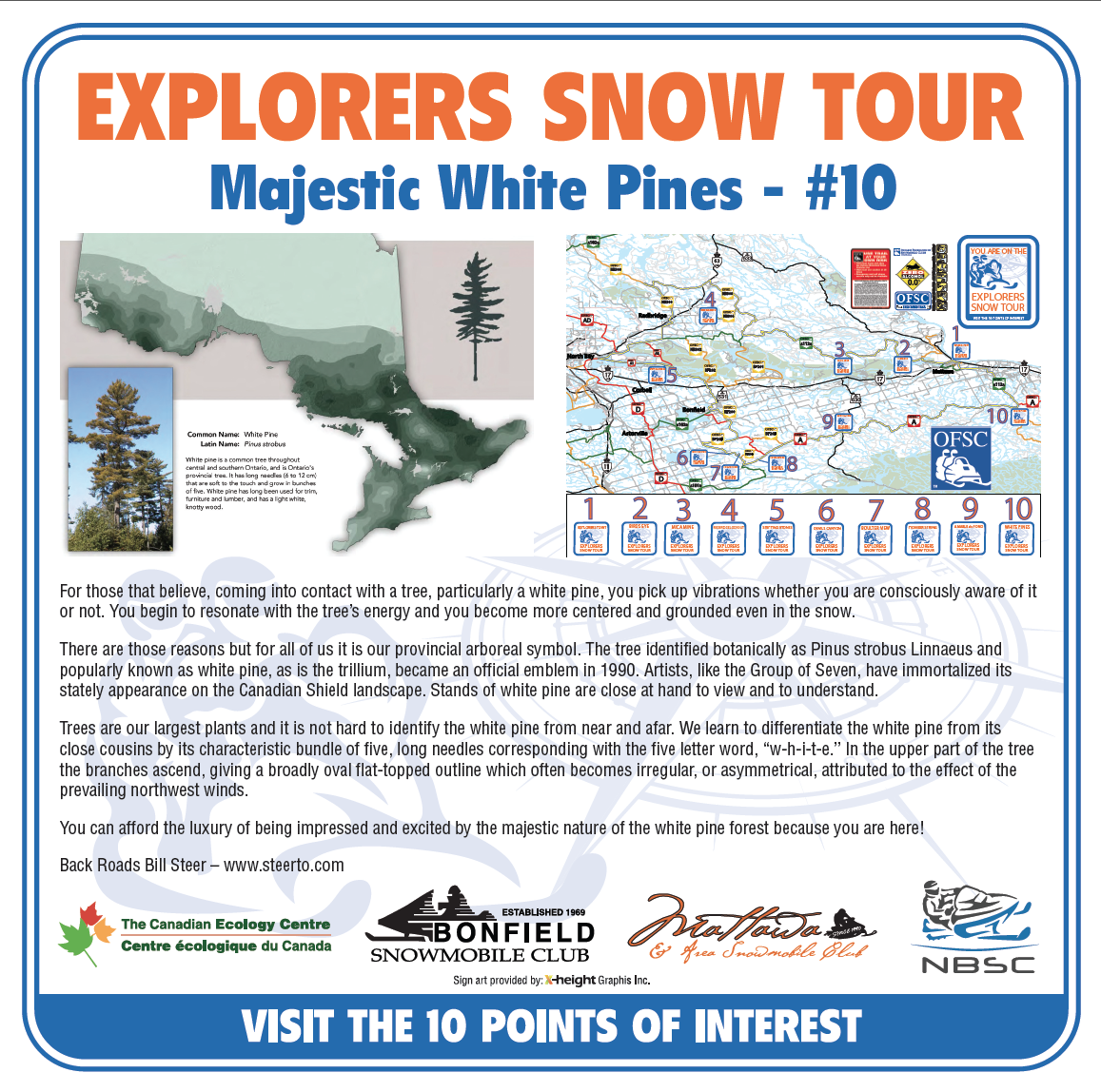
Majestic White Pines
We learn to differentiate the white pine from its close cousins by its characteristic bundle of five, long needles corresponding with the fiver letter word, “w-h-i-t-e”. An offical emblem of the province since 1999, you are sure to be impressed by the majestic nature of the white pine forest.
